Campground nearby 環球漁業
Taiwan
Campground nearby 環球漁業
環球漁業
320, Taiwan, 桃園市中壢區內定里
contacts phone
:
+886 3 455 5187
Latitude:
24.9870672
, Longitude:
121.2528732
larger map & directions
read more
nearest Campground
2.937 km
ㄚ洋林場
No. 72號, 龍安街二段1340巷50弄, Luzhu District
Campground
read more
5.032 km
無名草莓園
號, No. 39, Section 4, Nanzhu Road, Luzhu District
Campground
read more
6.763 km
Maomaoxiuxianxiao Station
蘆竹區蘆竹里
Campground
read more
7.151 km
林園居休閒農場
No. 56, 聖德北路1370 巷, Dayuan District
Campground
read more
8.444 km
福恩景觀園藝
桃 元 22 號, 福恩路, 中壢區
Campground
read more
8.551 km
7-13釣魚池
號, No. 66, 聖德北路, 大園區
Campground
read more
8.948 km
曾家休閒魚池
甲 九 圳
Campground
read more
9.129 km
利河伯休閒農園露營區
No. 19號, Renshan 2nd Street, Daxi District
Campground
read more
9.719 km
大溪魚菜工坊
290巷196弄13-1號, 瑞仁路, Daxi District
Campground
read more
9.739 km
7支15魚池
大園區溪海里
Campground
read more
10.633 km
建福魚池
No. 67, 東勢里8鄰金陵路七段167巷, Pingzhen District
Campground
read more
12.379 km
九斗魚池
新屋區九斗里
Campground
read more
12.667 km
簡家農場
525, 黃帝街, 蘆竹區
Campground
read more
13.351 km
32後花園露營區
No. 1, 坑口里後壁厝, Luzhu District
Campground
read more
13.49 km
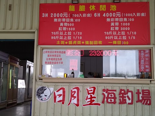
日月星海釣場
Unnamed Road, Dayuan District
Campground
read more
13.537 km
長福公園
Guangming Road, Sanxia District
Campground
read more
13.949 km
河岸休閒釣魚池
753 巷 號, No. 116, 民族路, 觀音區
Campground
read more
14.151 km
晴耕福田養生農莊
大溪區大溪
Campground
read more
14.165 km
柑園生態河濱公園 露營區
Unnamed Road, Shulin District
Campground
read more
14.671 km
恆生集團鴻禧露營區
Unnamed Road, Daxi District
Campground
read more
14.933 km
豬豬天堂
22, 106縣道, 林口區
Campground
read more
15.402 km
金東源露營地
Linkou District
Campground
read more
16.228 km
LRT 越野練習場
No. 625, 西部濱海公路, Linkou District
Campground
read more
16.423 km
浩然殷兜 (秘密基地)浩然之家(民宿)
Linkou District
Campground
read more
18.574 km
沐沐森林
13 鄰 56-1 號, 外詩朗路, 三峽區
Campground
read more
📑
all categories
Accounting
Administrative area level 1
Administrative area level 2
Airport
Amusement park
Aquarium
Art gallery
Atm
Bakery
Bank
Bar
Beauty salon
Bicycle store
Book store
Bowling alley
Bus station
Cafe
Campground
Car dealer
Car rental
Car repair
Car wash
Casino
Cemetery
Church
City hall
Clothing store
Colloquial area
Convenience store
Courthouse
Dentist
Department store
Doctor
Electrician
Electronics store
Embassy
Establishment
Finance
Fire station
Florist
Food
Funeral home
Furniture store
Gas station
General contractor
Grocery or supermarket
Gym
Hair care
Hardware store
Health
Hindu Temple
Home goods store
Hospital
Insurance agency
Jewelry store
Laundry
Lawyer
Library
Light rail station
Liquor store
Local government office
Locality
Locksmith
Lodging
Meal delivery
Meal takeaway
Mosque
Movie rental
Movie theater
Moving company
Museum
Natural feature
Neighborhood
Night club
Painter
Park
Parking
Pet store
Pharmacy
Physiotherapist
Place of worship
Plumber
Point of interest
Police
Post office
Premise
Real estate agency
Restaurant
Roofing contractor
Route
Rv park, camping
School
Shoe store
Shopping mall
Spa
Stadium
Storage
Store
Subpremise
Subway station
Supermarket
Synagogue
Taxi stand
Train station
Transit station
Travel agency
University
Veterinary care
Zoo
administrative area level 3
administrative area level 4
↑