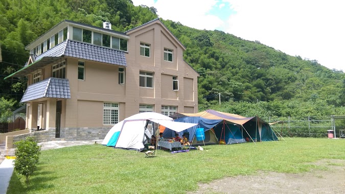
Campground nearby 水牛自然學校
Taiwan
Campground nearby 水牛自然學校
水牛自然學校
Dawo Road, 336, Taoyuan City, TW Taiwan
contacts phone
:
+886
Latitude:
24.8379842
, Longitude:
121.3582944
larger map & directions
read more
nearest Campground
813 m
露虹農場
基國派路520巷 復興區, 桃園市
Campground
read more
2.028 km
沐沐森林
13 鄰 56-1 號, 外詩朗路, 三峽區
Campground
read more
3.014 km
那山.達雅賀Ngasal Tayax
No. 2號, 霞雲里志繼2鄰, Fuxing District
Campground
read more
3.498 km
彩霞谷fun露營
No. 13-1, 金暖, Fuxing District
Campground
read more
3.642 km
喜樂麻谷
復興區霞雲里
Campground
read more
3.717 km
流霞谷親水烤肉園區
No. 金暖1號, 霞雲里1鄰, Fuxing District
Campground
read more
4.403 km
Governor Nuri fly Leisure Farm
霞雲里5鄰佳志20-1號, Fuxing District
Campground
read more
4.778 km
融奎霖休閒露營區
No. 13, 庫志9鄰, Fuxing District
Campground
read more
4.989 km
樂悠露營
No. 3-1號, 奎輝里2鄰下奎輝, Fuxing District
Campground
read more
5.076 km
恆生集團鴻禧露營區
Unnamed Road, Daxi District
Campground
read more
5.306 km
桃園復興馬灣露營區
霞雲里, Fuxing District
Campground
read more
5.98 km
卡普休閒農莊
No. 23號, 義盛里5鄰卡普, Fuxing District
Campground
read more
7.976 km
五葉松露營區
19 長興里11鄰, 長興里, 復興區
Campground
read more
8.073 km
蟾蜍山谷
No. 130-1號, 有木里6鄰, Sanxia District
Campground
read more
10.269 km
大溪魚菜工坊
290巷196弄13-1號, 瑞仁路, Daxi District
Campground
read more
11.676 km
Queens Town
No. 1號, Lane 95, Zhulun Road, Sanxia District
Campground
read more
13.467 km
尖石童話森林露營區
號, No. 149, Shuitian Road, Jianshi Township
Campground
read more
13.545 km
芭芘蕾露營區
水田, 4 鄰 139-1 號, Jianshi Township
Campground
read more
13.555 km
怪獸綠境露營區
新樂村水田, Jianshi Township
Campground
read more
13.757 km
River landscape ecological leisure park
No. 112-1, Jian'an Road, Sanxia District
Campground
read more
14.078 km
江江好苑
Xinyue Agricultural Road, Jianshi Township
Campground
read more
14.648 km
Hillside Leisure Farm (Camping)
新樂村水田, Jianshi Township
Campground
read more
15.205 km
羅馬之戀營地
阿化窩道路, Guanxi Township
Campground
read more
17.096 km
Bear Forest Camping
No. 160-9, 新樂村煤源段, Jianshi Township
Campground
read more
17.256 km
Payan露營區
尖石鄉新樂村
Campground
read more
📑
all categories
Accounting
Administrative area level 1
Administrative area level 2
Airport
Amusement park
Aquarium
Art gallery
Atm
Bakery
Bank
Bar
Beauty salon
Bicycle store
Book store
Bowling alley
Bus station
Cafe
Campground
Car dealer
Car rental
Car repair
Car wash
Casino
Cemetery
Church
City hall
Clothing store
Colloquial area
Convenience store
Courthouse
Dentist
Department store
Doctor
Electrician
Electronics store
Embassy
Establishment
Finance
Fire station
Florist
Food
Funeral home
Furniture store
Gas station
General contractor
Grocery or supermarket
Gym
Hair care
Hardware store
Health
Hindu Temple
Home goods store
Hospital
Insurance agency
Jewelry store
Laundry
Lawyer
Library
Light rail station
Liquor store
Local government office
Locality
Locksmith
Lodging
Meal delivery
Meal takeaway
Mosque
Movie rental
Movie theater
Moving company
Museum
Natural feature
Neighborhood
Night club
Painter
Park
Parking
Pet store
Pharmacy
Physiotherapist
Place of worship
Plumber
Point of interest
Police
Post office
Premise
Real estate agency
Restaurant
Roofing contractor
Route
Rv park, camping
School
Shoe store
Shopping mall
Spa
Stadium
Storage
Store
Subpremise
Subway station
Supermarket
Synagogue
Taxi stand
Train station
Transit station
Travel agency
University
Veterinary care
Zoo
administrative area level 3
administrative area level 4
↑