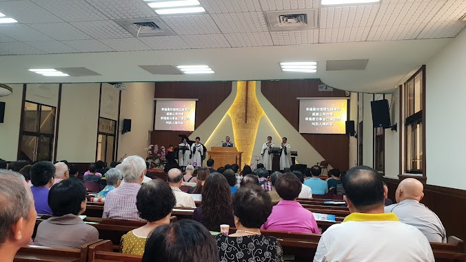
Church nearby 高雄芥菜種真道教會
Taiwan
Church nearby 高雄芥菜種真道教會
高雄芥菜種真道教會
163, Guangzhou 1st Street, 802, Kaohsiung City, TW Taiwan
contacts phone
:
+886 7 223 1470
Latitude:
22.6275188
, Longitude:
120.3157614
larger map & directions
read more
nearest Church
304 m
三一豐收教會
光華一路232號8樓之1, Lingya District
Church
read more
339 m
Kaohsiung Pentecostal Church
7th floor, No. 13, 民族二路, 新興區
Church
read more
486 m
Guanghua Presbyterian Church
No. 148, Guanghua 1st Road, Lingya District
Church
read more
579 m
台灣基督長老教會民族教會
信守街145號, Xinxing District
Church
read more
581 m
高雄基督之家
No. 20, Jintian Road, Xinxing District
Church
read more
783 m
生命發展教會
No. 21號, Bohai Street, Xinxing District
Church
read more
884 m
武昌教會
民權一路38號, Lingya District
Church
read more
892 m
高雄全牧教會-宣教中心
號, No. 195, 苓雅一路, 苓雅區
Church
read more
1.036 km
美國聖公會台灣教區高雄聖提摩太堂
3樓, No. 262, Zhongxiao 1st Road, Xinxing District
Church
read more
1.056 km
高雄市基督教浸信會
Xinxing District
Church
read more
1.091 km
財團法人基督教中華聖召會
No. 11, Minquan 1st Road, Lingya District
Church
read more
1.159 km
高雄基督喜信會
No. 152, Linsen 1st Road, Xinxing District
Church
read more
1.342 km
聖多瑪斯天主堂
Lingya District
Church
read more
1.346 km
天主教高雄教區
Lingya District
Church
read more
1.376 km
天主教法蒂瑪聖母堂
Xinxing District
Church
read more
1.382 km
七賢路禮拜堂
No. 467, Qixian 1st Road, Xinxing District
Church
read more
1.558 km
財團法人中華基督教衛理公會
No. 564, Zhongshan 2nd Road, Xinxing District
Church
read more
1.762 km
基督教高雄循理會
No. 1, Henan 2nd Road, Qianjin District
Church
read more
1.799 km
財團法人基督教中華循理會
No. 2, Henan 2nd Road, Xinxing District
Church
read more
1.897 km
和散那國度事奉教會
中華四路283號9F, Qianjin District
Church
read more
1.913 km
高雄基督神能教會
4 樓, No. 35, Yixin 2nd Road, Qianzhen District
Church
read more
1.937 km
財團法人基督教火車頭教會
No. 50, Hebei 2nd Road, Sanmin District
Church
read more
1.947 km
生命發展教會
建國三路85號11樓, Sanmin District
Church
read more
1.965 km
Liou-ho Presbyterian Church
Liuhe 2nd Road, Qianjin District
Church
read more
2.314 km
主大永教會
號, No. 495, 九如二路, 三民區
Church
read more
📑
all categories
Accounting
Administrative area level 1
Administrative area level 2
Airport
Amusement park
Aquarium
Art gallery
Atm
Bakery
Bank
Bar
Beauty salon
Bicycle store
Book store
Bowling alley
Bus station
Cafe
Campground
Car dealer
Car rental
Car repair
Car wash
Casino
Cemetery
Church
City hall
Clothing store
Colloquial area
Convenience store
Courthouse
Dentist
Department store
Doctor
Electrician
Electronics store
Embassy
Establishment
Finance
Fire station
Florist
Food
Funeral home
Furniture store
Gas station
General contractor
Grocery or supermarket
Gym
Hair care
Hardware store
Health
Hindu Temple
Home goods store
Hospital
Insurance agency
Jewelry store
Laundry
Lawyer
Library
Light rail station
Liquor store
Local government office
Locality
Locksmith
Lodging
Meal delivery
Meal takeaway
Mosque
Movie rental
Movie theater
Moving company
Museum
Natural feature
Neighborhood
Night club
Painter
Park
Parking
Pet store
Pharmacy
Physiotherapist
Place of worship
Plumber
Point of interest
Police
Post office
Premise
Real estate agency
Restaurant
Roofing contractor
Route
Rv park, camping
School
Shoe store
Shopping mall
Spa
Stadium
Storage
Store
Subpremise
Subway station
Supermarket
Synagogue
Taxi stand
Train station
Transit station
Travel agency
University
Veterinary care
Zoo
administrative area level 3
administrative area level 4
↑