Doctor nearby 和美診所
Taiwan
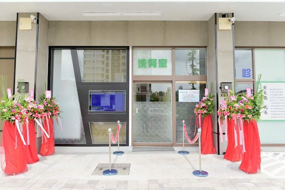
Doctor nearby 和美診所
和美診所
46號, Ruiping Road, 811, Kaohsiung City, TW Tajwan
contacts phone
:
+886 7 368 1658
Latitude:
22.722704
, Longitude:
120.3118989
larger map & directions
read more
nearest Doctor
59 m
毓汫傳統整復推拿館
號, No. 141, Ruiren Road, Nanzi District
Doctor
read more
430 m
學士眼镜
區東路5號, Nanzi District
Doctor
read more
550 m
昇發
號, No. 13, 後勁西路56巷, 楠梓區
Doctor
read more
846 m
Dr Chrn Dental Clinic
No. 354, Dexian Road, Nanzi District
Doctor
read more
1.448 km
林邑樵耳鼻喉科診所
高雄市楠梓區益群路6號
Doctor
read more
1.795 km
家毅復健科診所
No. 19, Lantian Road, Nanzi District
Doctor
read more
1.983 km
廣佑安診所
No. 782, Demin Road, Nanzi District
Doctor
read more
2.101 km
高雄心欣診所(身心科/精神科)
No. 822, Demin Road, Nanzi District
Doctor
read more
2.11 km
楠梓心寬診所
號, No. 128, 後昌新路, Nanzi District
Doctor
read more
2.292 km
佑強診所
No. 908號, Demin Road, Nanzi District
Doctor
read more
2.355 km
佳澤診所
No. 207, Daxue East Road, Nanzi District
Doctor
read more
2.433 km
楊煌榮內兒科診所
No. 972號, Jiachang Road, Nanzi District
Doctor
read more
2.542 km
鄧凱太家仁診所
No. 991, Demin Road, Nanzi District
Doctor
read more
2.552 km
翁仲仁婦產科診所
No. 1010-5, Demin Road, Nanzi District
Doctor
read more
2.89 km
祐祥中醫診所
No. 718, Youchang Street, Nanzi District
Doctor
read more
4.935 km
李全忠診所
No. 528號, Ziyou 3rd Road, Zuoying District
Doctor
read more
5.057 km
林政賢皮膚科診所
No. 718號, Huasia Road, Zuoying District
Doctor
read more
5.081 km
華夏診所
No. 708號, Huasia Road, Zuoying District
Doctor
read more
5.114 km
乃聖診所
No. 232號, Wenqiang Road, Zuoying District
Doctor
read more
9.151 km
文心小兒科診所
No. 103之1號, Pingdeng Road, Sanmin District
Doctor
read more
10.247 km
美兆診所
182號14樓之3, Zhongzheng 2nd Road, Xinxing District
Doctor
read more
10.469 km
元和雅-高雄分院
No. 125, Zhonghua 3rd Road, Qianjin District
Doctor
read more
13.147 km
馬蘭中醫診所
Guanzhong South Road, Qianzhen District
Doctor
read more
13.294 km
郭俊榮骨科專科診所
No. 540號, Baotai Road, Qianzhen District
Doctor
read more
13.935 km
健聖診所
No. 2號, Zhongzheng Road, Daliao District
Doctor
read more
📑
all categories
Accounting
Administrative area level 1
Administrative area level 2
Airport
Amusement park
Aquarium
Art gallery
Atm
Bakery
Bank
Bar
Beauty salon
Bicycle store
Book store
Bowling alley
Bus station
Cafe
Campground
Car dealer
Car rental
Car repair
Car wash
Casino
Cemetery
Church
City hall
Clothing store
Colloquial area
Convenience store
Courthouse
Dentist
Department store
Doctor
Electrician
Electronics store
Embassy
Establishment
Finance
Fire station
Florist
Food
Funeral home
Furniture store
Gas station
General contractor
Grocery or supermarket
Gym
Hair care
Hardware store
Health
Hindu Temple
Home goods store
Hospital
Insurance agency
Jewelry store
Laundry
Lawyer
Library
Light rail station
Liquor store
Local government office
Locality
Locksmith
Lodging
Meal delivery
Meal takeaway
Mosque
Movie rental
Movie theater
Moving company
Museum
Natural feature
Neighborhood
Night club
Painter
Park
Parking
Pet store
Pharmacy
Physiotherapist
Place of worship
Plumber
Point of interest
Police
Post office
Premise
Real estate agency
Restaurant
Roofing contractor
Route
Rv park, camping
School
Shoe store
Shopping mall
Spa
Stadium
Storage
Store
Subpremise
Subway station
Supermarket
Synagogue
Taxi stand
Train station
Transit station
Travel agency
University
Veterinary care
Zoo
administrative area level 3
administrative area level 4
↑