Pharmacy nearby 中山福倫藥局
Taiwan
Pharmacy nearby 中山福倫藥局
中山福倫藥局
483號, Zhongshan Road, 403, Taichung City, TW Taiwán
contacts phone
:
+886 4 2202 6818
website:
www.fulun.com.tw
Latitude:
24.1468643
, Longitude:
120.6728018
larger map & directions
read more
nearest Pharmacy
282 m
鑫祐藥局
No. 302, Minquan Road, West District
Pharmacy
read more
335 m
美德中藥行
125-5號, 原子街, 北區
Pharmacy
read more
335 m
國峰西藥行
台灣省北區台灣大道一段607號
Pharmacy
read more
349 m
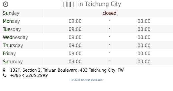
拓撲藥品股份有限公司
號, No. 132, Section 2, Taiwan Boulevard, West District
Pharmacy
read more
369 m
中港大藥局
No. 132號, Section 2, Taiwan Boulevard, West District
Pharmacy
read more
458 m
昆達藥局
No. 135號, Yuanzi Street, North District
Pharmacy
read more
567 m
松鶴藥局
No. 224號, Duxing Road, North District
Pharmacy
read more
619 m
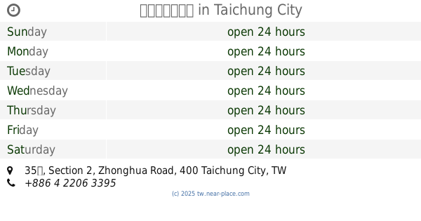
佑全藥局中華店
No. 35號, Section 2, Zhonghua Road, Central District
Pharmacy
read more
656 m
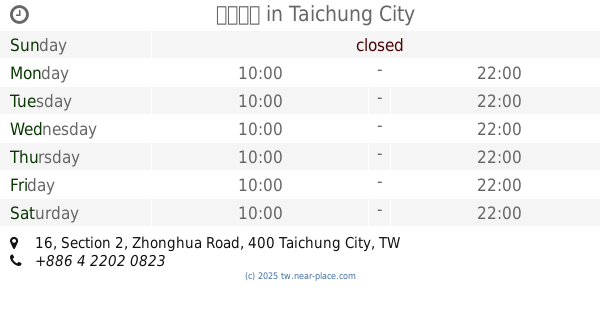
正興藥局
号, No. 16, Section 2, Zhonghua Road, Central District
Pharmacy
read more
680 m
老順安大藥局24H
No. 63, Section 2, Zhonghua Road, Central District
Pharmacy
read more
700 m
祥泰健保大藥局
號, No. 95, 公園路, 中區
Pharmacy
read more
751 m
辰豐中西藥局
Chenggong Road, Central District
Pharmacy
read more
936 m
仁壽藥局
No. 1號, Section 3, Sanmin Road, Central District
Pharmacy
read more
1.004 km
新泰華西藥房
No. 131, Taiping Road, North District
Pharmacy
read more
1.022 km
順正中西藥局
No. 292號, Yingcai Road, North District
Pharmacy
read more
1.072 km
宏達大藥局
No. 370-2, Wuquan Road, North District
Pharmacy
read more
1.093 km
雙安藥局
No. 366之2號, Duxing Road, North District
Pharmacy
read more
1.22 km
仁安大藥局
No. 150號, Section 1, Meicun Rd, West District
Pharmacy
read more
1.491 km
保宏藥局
No. 107號, Gongguan Road, West District
Pharmacy
read more
1.494 km
屈臣氏Watsons
台灣大道一段25號1-3F, Central District
Pharmacy
read more
1.496 km
致安藥局
號 1 樓, No. 176, 美德街, 北區
Pharmacy
read more
1.594 km
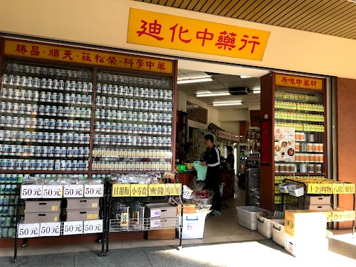
迪化中藥行
成功路18號, Central District
Pharmacy
read more
1.619 km
中一藥局
No. 222號, Jianguo Road, Central District
Pharmacy
read more
1.62 km
金福記中藥行
No. 218, Jianguo Road, Central District
Pharmacy
read more
1.932 km
崇文藥師藥局
號 No. 99, 梅川西路三段, 北區
Pharmacy
read more
📑
all categories
Accounting
Administrative area level 1
Administrative area level 2
Airport
Amusement park
Aquarium
Art gallery
Atm
Bakery
Bank
Bar
Beauty salon
Bicycle store
Book store
Bowling alley
Bus station
Cafe
Campground
Car dealer
Car rental
Car repair
Car wash
Casino
Cemetery
Church
City hall
Clothing store
Colloquial area
Convenience store
Courthouse
Dentist
Department store
Doctor
Electrician
Electronics store
Embassy
Establishment
Finance
Fire station
Florist
Food
Funeral home
Furniture store
Gas station
General contractor
Grocery or supermarket
Gym
Hair care
Hardware store
Health
Hindu Temple
Home goods store
Hospital
Insurance agency
Jewelry store
Laundry
Lawyer
Library
Light rail station
Liquor store
Local government office
Locality
Locksmith
Lodging
Meal delivery
Meal takeaway
Mosque
Movie rental
Movie theater
Moving company
Museum
Natural feature
Neighborhood
Night club
Painter
Park
Parking
Pet store
Pharmacy
Physiotherapist
Place of worship
Plumber
Point of interest
Police
Post office
Premise
Real estate agency
Restaurant
Roofing contractor
Route
Rv park, camping
School
Shoe store
Shopping mall
Spa
Stadium
Storage
Store
Subpremise
Subway station
Supermarket
Synagogue
Taxi stand
Train station
Transit station
Travel agency
University
Veterinary care
Zoo
administrative area level 3
administrative area level 4
↑