Gym nearby 高雄市體育處健身中心
Taiwan
Gym nearby 高雄市體育處健身中心
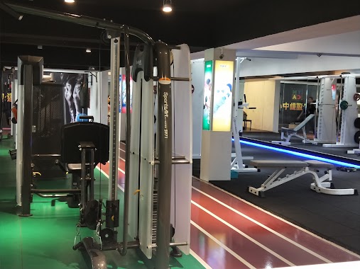
高雄市體育處健身中心
802, Taiwan, 高雄市苓雅區福西里
contacts phone
:
+886 7 722 9494
Latitude:
22.626181
, Longitude:
120.334405
larger map & directions
read more
nearest Gym
279 m
中正網球場 (俱樂部)
號, No. 19, Jianmin Road, 苓雅區
Gym
read more
279 m
中正網球場 (俱樂部)
號, No. 19, 建民路, 苓雅區
Gym
read more
393 m
中正桌球聯誼會
No. 8, Zhongzheng 1st Road, Lingya District
Gym
read more
678 m
100M above ground Robert
802, 建民路, 苓雅區
Gym
read more
755 m
張微微舞蹈工作室
號 5 樓, No. 284, Zhongzheng 1st Road, Lingya District
Gym
read more
870 m
美憶運動館-武廟館
武廟路136號, 2樓, Lingya District
Gym
read more
888 m
I-Bounce 親子互動教室
輔仁路377號, Lingya District
Gym
read more
953 m
鷹CrossFit Zing
No. 11, Lane 135, Wumiao Road, Lingya District
Gym
read more
1.013 km
香水SPA會館
No. 271號, Zhongzheng 1st Road, Lingya District
Gym
read more
1.316 km
鳳西遙控飛行場
No. 285巷60號, Ziyou Road, Fengshan District
Gym
read more
1.474 km
穿山甲運動廣場
穿山甲
Gym
read more
1.493 km
YMCA健身運動中心
No. 433, Heping 2nd Road, Lingya District
Gym
read more
1.5 km
YMCA和平健身運動中心
號, No. 433, 和平二路, 苓雅區
Gym
read more
1.518 km
微笑光瑜伽療法
高雄市苓雅區林泉街8巷22號1樓, 苓雅區
Gym
read more
1.65 km
藍色公路游泳池
No. 151號, Xianzheng Road, Lingya District
Gym
read more
1.697 km
單槓世界街頭健身訓練中心
No. 579號8樓, Juemin Road, Sanmin District
Gym
read more
1.77 km
鬥犬健身中心
No. 254號, Heping 2nd Road, Qianzhen District
Gym
read more
1.785 km
葉問詠春
No. 12, Lane 91, Minli Road, Sanmin District
Gym
read more
1.812 km
伍十撞球
No. 119之2號 5樓, Dachang 2nd Road, Sanmin District
Gym
read more
1.855 km
綠種子舞蹈空間
號, No. 79, 褒揚街, 三民區
Gym
read more
2.048 km
Curves
3 樓, No. 805, Jiuru 1st Road, Sanmin District
Gym
read more
2.074 km
Fitness Factory factory Fengshan
No. 466-1, Chengqing Road, Sanmin District
Gym
read more
2.329 km
乾元保健傳統整復推拿所
號, No. 80, Yuejiang Street, Qianzhen District
Gym
read more
2.336 km
Anytime Fitness 高雄文山店24小時健身房
No. 138, Wenbin Road, Fengshan District
Gym
read more
2.461 km
美憶運動健康館
二樓, No. 375-1, Section 2, Qingnian Road, Fengshan District
Gym
read more
📑
all categories
Accounting
Administrative area level 1
Administrative area level 2
Airport
Amusement park
Aquarium
Art gallery
Atm
Bakery
Bank
Bar
Beauty salon
Bicycle store
Book store
Bowling alley
Bus station
Cafe
Campground
Car dealer
Car rental
Car repair
Car wash
Casino
Cemetery
Church
City hall
Clothing store
Colloquial area
Convenience store
Courthouse
Dentist
Department store
Doctor
Electrician
Electronics store
Embassy
Establishment
Finance
Fire station
Florist
Food
Funeral home
Furniture store
Gas station
General contractor
Grocery or supermarket
Gym
Hair care
Hardware store
Health
Hindu Temple
Home goods store
Hospital
Insurance agency
Jewelry store
Laundry
Lawyer
Library
Light rail station
Liquor store
Local government office
Locality
Locksmith
Lodging
Meal delivery
Meal takeaway
Mosque
Movie rental
Movie theater
Moving company
Museum
Natural feature
Neighborhood
Night club
Painter
Park
Parking
Pet store
Pharmacy
Physiotherapist
Place of worship
Plumber
Point of interest
Police
Post office
Premise
Real estate agency
Restaurant
Roofing contractor
Route
Rv park, camping
School
Shoe store
Shopping mall
Spa
Stadium
Storage
Store
Subpremise
Subway station
Supermarket
Synagogue
Taxi stand
Train station
Transit station
Travel agency
University
Veterinary care
Zoo
administrative area level 3
administrative area level 4
↑